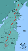
Wednesday, June 27, 2007

6/24 Close Encounter of the Deer Kind

20.3 hiked today, 1442.8 miles N, 731.2 miles left
Ten Mile River Lean-To


Slept in today and got caught up talking with Joel. He was a very interesting person and I enjoyed to talking to him greatly but finally I had to break out and get some miles under my belt inspite of the late start. McGyver and I hiked well making it 4.5 miles to Nuclear Lake before McGyver had the wise idea of relaxing on a rocky point sticking out into the lake. It was a gorgeous spot with smooth waters, warm sun, small fish swimming around. Around us flew dragon flies in brilliant sometimes iridescent colors. The lake gets it's name from the nuclear fuel processing plant that used to be on it's shore tough it now is only surrounded by serene woods.
Later on I came across a small garter snake in the trail. it was a youth about as wide as my finger and a foot and half long. In a minute it minute it got scared and ran off.
After that we came to the Dover Oak tree. It is thought to be the biggest tree on the AT and seeing it I have no doubts. It was a massive tree with a base that has makes every other tree I have ever seen seem small. It's branches stretched wide and were thick enough to be large trees of their own. It is astonishing to imagine there once was a time when the whole east coast was covered with trees like this!
Then another unique sight on the AT, a train station. On weekends one can catch a train for a direct ride to and from Manhattan. It was a spartan affair lacking even a roof but attractive none the less. I suspect they assume person hearty enough to hike the AT are hearty enough to bring rain jackets.
Just after that we were at a road crossing with a deli an easy walk away. While doing the .4 miles to the deli we walked next to the highway that was surrounded by thick brush and grass. Suddenly we heard a noise just behind us and a deer came charging out of the brush right at us. Upon seeing us it cut left and ran between the woods and us before suddenly cutting back into the woods 15' later and disappearing. The whole affair last only a second or two. I think it got within arms reach when it passed by. McGyver and I looked at each other stunned and then kept walking for the lack of anything to do.
We hit Tony's deli and had a relaxed break in the shade of a tree and then hiked across the Connecticut border thus completing my deli tour.
New York had been am mixed state. It certainly nice to be able to have a fresh sandwich every day and the zoo was very neat. On the other hand some of trail was trashed or badly built. All in all Ihad a good time but New Jersey was better.
CT has turned out very nice in the first few miles with awesome trail magic by Mac N' Cheese. Just past a road crossing were several patio chairs set up with a large drink cooler of ice water, two coolers one with chilled food and the other with misc hiker supplies. We took and enjoyable break there and recharged munching on guacamole and chips and drinking Gatorade before heading into the shelter just at dark.
There we meet Matt "Sketch" and U-Dog who's journal sketches/comics have been a pleasure to read for the last couple months. I fear I may miss them if I pass Matt up. Wolverine was also there, McGyver had hiked with him before but I was just meeting him for the first time.
The shelter is located on the edge of a large field where were the air is filled with the twinkle of hundreds of lightning bugs.

6/23 Another Day on the Deli Tour

19.7 hiked today, 1422.5 miles N, 751.5 miles left
Morgan Stewart Shelter

For some reason today I awoke at 5:59AM feeling refreshed and ready to go. Not wanting to waste such a happy circumstance I got my start at 6:30 while it was still cool out. Early on I am came across something that set me wondering. For about a mile the trail was perfectly flat owing to a stone walkway with dirt top. At some places the walkway towered at least 15' above the forest floor. I am sure it was very old made for some other purpose, I suspect narrow gauge rail. It is another one of those times when I wish there was a historical sign explaining the area. Through out the trail we can see numerous old stone walls that were all built by hand 100, 200, or even more years ago. I wish I knew the stories of the people who clear cut these woods, picked up the rocks, and managed to presumably scrape a living up from the steep and rocky slopes.
McGyver caught up with me as we reached Canopus Lake. The lake had a very inviting beach as we rounded one of it's sides and then headed back up the mountain.
When we took a lunch break and were lucky enough to find some wild blue berries right where were sat. They are much smaller than the ones we normally get at the grocer but still taste great. Thus the lunch of thru-hikers today was blue berries, a handful of nuts, and a Little Debbie Cosmic Brownie.
The top of Shenandoah Mountain was a disappointment with the summit scared by numerous fire rings, a flag painted into the rock with "Never forget Sept 11th", and trash strewn all over. On the upside some of the trash was unopened and McGyver and I got a few candy bars. We could have had beer or vodka if we had chosen to but it was too hot for that. We cleaned up and packed out as much trash as we could which turned out to be about 2/3 of what was up there and made a small pile of what was left.
At the next road crossing we were lucky to find someone who agreed to haul out the trash in his car saving us from carrying it around all day.
At RPH shelter McGyver decided to take a long break and I continued on. The trail has continued the climbs and descents all day that is again becoming the status quo. My climbing legs are pretty much back and I am finding myself generally cruising throught he elevation changes. The trail surface is very good though, especially the segment over Stormville Mountain where it was obvious someone had put a lot of effort into this trail. The trail switchbacked frequently to make for a very easy slope and it was lined by rock walls that were the rocks that had been removed from the trail. There was a short article about how this section used to go steeply up and down the mountain until a local maintainer decided to to do something about it. The trail was well built that I didn't notice the 500' of uphill. It just shows what good trail can do for a difficult section! Just after that I did my walk to a deli to get another sandwich and keep the deli tour alive.
When I reached the road on the other side of the road was a deer munching away at the grass. I got a couple of pictures before grabbing my sandwich and slice of pizza.
The rest of the day was fairly uneventful until reaching the shelter where I was greeted by a busy shelter. Fortunately everyone turned out to be very friendly. Seven of the my fellow hikers tonight are a transplanted Ecuadorian family out for a weekend trip. They have collected the most firewood I have seen yet on this trip so I am sure the fire will be going strong all night. They were very kind and made space for me in the shelter for the night when I arrived and were very interested in the life of a thru-hiker. The interest went both ways with me learning about their Andies hikes and jungle hiking. Later we were joined by Joel, a reporter for the Wallstreet Journal, ad McGyver who caught up after taking long break.

Monday, June 25, 2007

6/22 A New Low

20.9 hiked today, 1402.8 miles N, 771.2 miles left
Denneytown Road Parking Lot

The skyline was awesome last night. Down below the Hudson was invisible but the dots of light from the homes that surround it carefully outlined it. Again New York was visable even better due to it's lights.
Last night it turns out I walked about 10 feet from McGyver and we didn't see each other. We met up early at the top of Bear Mountain. The top of the mountain is the high point os the AT in NY and to add to this there is a tower on top of it to get one above the trees. McGyver and I enjoyed this view before heading down the other side and into a zoo. It was the "Trailside Museums and Wildlife Center" where one could see all sorts of wild life and exhibits about the natural features of the area. We had a good time reading all the signs and trying to memorize the names of everything we see on a daily basis. The zoo also has the lowest point on the entire AT. It was located at the bear exhibit at and elevation of 124 feet above sea level. After that we crossed the Hudson on the Bear Mountain Bridge which features phones that auto dial a suicide prevention hot-line. The trail rose steeply up the other side of the river. We bounced along the ridge for a while before descending to another road where we hitched to Peekskill. The hitch was a rough one taking a long time but when we finally got it it turned out getting into town involved a large number for turns and a exit ramp. This made it nearly impossible to get back to our dismay.
In town we took care of our supply needs and picked up lunch. The man behind the counter at D&J's deli showed me some of his hospitality by over charging me by a $1. When I corrected him he denied it and then rung up my credit card for the dollar extra anyhow. Instead of picking a fight I just sucked it up but between the hitch and the jerk of a deli owner I recommend one stays away from Peekskill. The other people in town turned out to be very nice though. The library provided us with internet access and while we were at the bus stop trying to figure out where we were on the map someone stopped and asked if we needed a ride to trail. They had to drop someone off but they were back in 10 minutes and drove us back to where we had left off. That was an amazing but of luck!
After that we stopped by a campsite at Graymoor Friary where we got water and chatted with some thru-hikers spending the night. Again we made it a late night though pushing on until just before dark. At the Dennytown road junction there is a water spigot to get water and the woods just past the road are a very agreeable spot where we are spending the night.

6/21 What a view

19.7 hiked today, 1382.5 miles N, 791.5 miles left
West Mountain Shelter

A good nights sleep in NY. When Caps and I woke we found McGyver was already gone. We packed up and left. Early on we came across a pond where there were more huge bull frogs. When we would got near they would let out a great croak that sounded like someone plucking the bass note of a guitar before hopping into the water. In addition to the frogs there were small blue gill fish swimming around in the water. Later on the trail Caps' sharp eyes spotted a tiny toad no bigger than my thumb nail. At about 9AM we crossed a road where I did the half mile walk to the deli while caps stayed behind and relaxed. While waiting for my sandwich I saw they have TV bingo now and decided I will stay in the back-country for at least another 7 weeks.
I got my sandwich, hiked back to the trail, and packed it up for lunch.
We have been hearing booms all day and at first I thought it was gun fire from local shooting range though it was louder than I had heard before. At the deli I found out West Point is only 20 miles away and what we had been hearing was cannon fire. Wow, if that is what it sounds like here I wonder how loud it is by the cannon.
Caps I I hiked very slowly in the morning. After four hours we had only covered six miles. I knew we were coming up on a stretch of trail called Agony Grind. I never knew if we had reached it yet though because all the trail was rough continuously steep up and down over boulders and rock piles. It was insane. We never changed elevation more than 100' at a time but I swear we climb near a 1000' in a couple miles there. After that slow part we decided to take a break at NY17. I had my sandwich and we took naps. I got up first to make calls and take care of email from a nearby pay phone.
After that we hiked into another rough stretch of trail, the Lemon Squeezer. That wasn't so bad, just a narrow slot between some boulders but after that the trail was routed right over a vertical 8' rock face. There was a an easy path around it but I decided to go over the "true" AT and after a few attempts I managed to haul myself over it almost completely by using my atrophied upper body.
After that the trail mellowed out and we made good time once more. That doesn't mean that it flattened though. It feels a lot like Georgia where one is always going up or down hill. For people who started in GA this is not much of a big deal but I suspect this is the first terrain of this sort Caps has hiked as he got really annoyed. To add to his bad temperment was the rain which had whipped up. We put on our pack covers and trudged on up and down the mountains. The rain stopped for a while but that did not mean we dried out. In some parts there were dense bushes growing into the trail and when we brushed up against them we got soaked anew. In fact we had stayed comfortably dry in the rain but from the bushes we were soaked through. Then again it started to rain as we hiked. The lightning was cool at least. It seemed to be staying mostly in clouds. I would hear a rumble of thunder overhead to one side and then I would hear it expand until the sound was coming from all directions. Then there would be a sort wave of crackling before it died off. I am glad I was in the trees for this!
The shelter is way off the trail tonight. Just at the turnoff there is a great overlook to the west and we arrived just in time to see the sun descend from the ceiling of clouds into the red void that separated them for the earth. I stayed behind to watch and take pictures while Caps pushed on to the shelter. The sun set was stunning and when it finally finished dipping below the horizon I headed to the shelter too.
The shelter is indeed a long walk off trail but it is worth it. It is on top of a huge flat rock that commands a wide view of the horizon. Below and to my left is the Hudson river meandering through the mountains. To my right New York is again visible on the horizon.
After I cooked my dinner I forgot to pick up my stove. As a result I accidentally stepped on it and sort of crushed it. I tried to pop out the dents and we will see if it still works when I make dinner tomorrow.

6/20 Day 2 of the Deli Tour

15.8 hiked today, 1363.6 miles N, 810.4 miles left
Mombasha High Point

It rained pretty much all night last night. Also the skeeters keep up their buzzing until a put on a little DEET. It stayed hot so I couldn't hide in my sleeping bag. It makes me long for the hammock again. If this hot spell keeps up I may just try to get it back.
The skeeters were not the only pest, something had been nibbling at my gear. There was a hole in my water bottle and another had been nibbled into my water proof data/map cover.
After all that unpleasantness it was still drizzling when I hit the trail. Fortunately it stayed cool and the drizzle let up fairly soon after I started. I did not have an aggressive day planned so along with Caps and McGyver I took a lot of breaks enjoying the sights and generally relaxed.
Today I passed from New Jersey to New York. Eight states down and six to go. They are coming fast now that they aren't hundreds of miles long.
There was an ice cream shop a short walk from one of the road crossings and we paid a visit. It was situated on top of a view of the valley below and we all enjoyed our ice cream as we looked out into the landscape and watched the birds. I was keen on getting a replacement water bottle for the one chewed by a mouse but that involved a long walk down and up the steep road leading to the pass we were in. I asked around and struck up a conversation with a couple people who were doing water quality research in local farms. There weren't heading in my direction but they agreed to give me a quick lift down the hill anyhow. At the bottom of the hill was another deli where I got another yummy sandwich and a 1 L Pepsi before they gave me a lift back up. With my stop on the Deli tour and water bottle issues taken care of we relaxed at the picnic tables looking out at the view some more before packing up and heading on down the trail.
I have seen a lot of wildlife today. Earlier we flushed a grouse from it's nest and it did a good job of distracting us from it's eggs. Later we spotted several red spotted newts in the trail. I found a tick on my knee but fortunately he had not bitten yet. Finally Caps spotted a praying mantis while we were at the ice cream shop.
We hiked until early evening and since the weather seems to be nice we have camped out on the summit of Mombasha mountain. There is not much space up here but I managed to find a grassy spot about 7 feet long to stretch out into. The view up here is great. If I stand in the right spot I can see the skyline of New York City rising up above the mountains to the south. The areas closer by are generally green and pleasant too. The wind is cool and comfortable and I think I will get to zip up my sleeping bag tonight. I hope the weather stays nice since I haven't rigged my tarp.

6/19 Motivational Issues

5.3 hiked today, 1347.8 miles N, 826.2 miles left
Wawayanda Shelter

As the title says I had a motivational problem today. It was too hot and sunny out (95 degrees) and the church too cool and comfy (about 70 degrees). I am not even sure what I did. One thing was I got some fresh produce from A&P and using the eggs and cheese in the hiker fridge I made a huge batch of scrambled eggs with spinach, sauted onions and peppers, and tomatoes for lunch.
Finally at 6PM McGyver, Caps, and I all agreed we had to get out of town or risk getting caught again tomorrow. Once again we hiked like crazy and arrived after dark.
The site is pretty crowded but most people are staying in tents. As I set up I found out why. Even though a storm is looming they were setting up outside in droves to avoid the mosquitoes. I put on my head net and wind clothes which is doing a pretty good job keeping them away.
..
Now the rain is really coming down and the wind has picked up so I am glad I am in here rather than having to dry off in the morning.

6/18 Wet Land Tours

12.6 hiked today, 1342.5 miles N, 831.5 miles left
St. Thomas Episcopal Church Hostel in Vernon, NJ

Once more a late start but today we didn't have great goals so we made it into town before dark. I slept great last night! The fan was blowing a cool breeze over us and the white noise covered up the sounds of the donkeys and tractor in the adjacent field. I didn't get to speak to the driver of the tractor though we did exchange friendly waves. I suspect he is the provider of the fine shelter. Since we all slepty in by the time we woke and started packing the temperature had gotten quite hot though that may largely due to the lack of cover in a field of golden and green grasses.
A couple miles up the trail we did our first of two town stops in Unionville. There they had a small grocery that seemed to carry everything we needed. I purchased a 1L pop because last night in the dark I lost mine somewhere on the trail. They had Slurppies too. I bought a couple of energy drinks to make a new simmering stove. My previous one did work but it tends to go out and scorch the surface it is on. Finally I got a sandwich in honor of the deli tour. In New York one can hike to a deli every day hence the "deli tour". I have personally been craving sandwiches for the last three months so I plan on taking advantage of this. Caps bought a 25oz Fosters beer to use the can for a pot. We made a fine pair, one wired and one buzzed. We took a two hour long lunch break at a picnic table behind the market. I made Caps a pot and myself a stove which turned out not to work very well so I threw it out.
From Unionville the hiking was exceptionally easy generally sticking to low areas. We made great millage though Caps and McGyver were annoyed at the long tour around the perimeter of Walkill River National Wildlife Refuge rather taking the short route around the other side. I rather liked it because I found the green waters and reedy plants relaxing and there were many swans swimming about.
After Walkill we did our one significant climb going up Pochuck mountain. The climb was very poorly graded and we pretty much went straight up the steep mountain side. To our delight we found an unlabeled water source on the way up. There was a sign on a tree pointing to our right. I had plenty but Cap needed some so we stopped. When Caps went to fill up he found a large steel box with not only water but also all sorts of treats left by a trail angel. Thank you very much whoever you are!
We took another short break at the shelter. We ended climbing so quickly that we were up and over before I knew it. That was a shame as I wanted to check out the overlook on the summit but I missed it. Then we went down the other side quickly minus a break for Caps' still sore feet. There we entered the Pochuck wetland. This one was fairly dry but absolutely filled with tall cat tails, grasses, and wild flowers. You could walk right though on an astonishing 4400' long boardwalk and a 110' span suspension bridge. It was a stunning expanse where the plants were so tall that though the board walk was 4-5 feet off the ground the plants came to over my chest in many cases.
Pretty much right after that we were on the road into town. The hitch into town took about 20 minutes and the ride was very nice and dropped us off right at the hostel. MGyver and Caps moved on to the firehouse where there was free camping. I elected to stay and pay the $10 for internet, shower, and laundry. At the hostel I emailed Platypus about my popped bladder and Princeton Tec about my headlamp that is acting up. Then I figured out why I hadn't found my shoes that I ordered. I had them shipped to the wrong town! Oops, tomorrow I will have to call the post office and have them forwarded. After all that finally I had a chance to get dinner and headed out to the local pizza place. There the people were very nice and portions huge. I got a salad and a couple slices of pizza. I was there late but they let me stay after they closed while they cleaned up. I heard the cook asking the staff if they wanted any pizza as he was throwing out the pre-made ones he had around for slices. He wasn't having any takers and then I piped up saying that I knew thru-hikers that would eat it. In the end I got a salad, two large slices of pizza, and a whole 16-18" cheese pizza for about $10. I hit the A&P grocery that was in the same mall and bought some food and V-8 cans to try to make another simmer stove. Then I crossed the street to hang out with Caps and McGyver at the fire house. The city was well laid out for a hiker with all the stores and post office in one mall and the camping across the street by the side of a pond with lilies and ducks. It is a real nice spot to spend the night.
We hung out for a while and chatted before drowsiness kicked in for me. I grabbed their laundry and took it back to the hostel where I have tossed it in with my load and am waiting for the cycle to finish so I can toos it into the dryer and then pass out.

Friday, June 22, 2007

more photos

well, I did a few more days; they are done through 5/9 I believe I last reported photos being added through 5/1 so it's about a week more.

Tuesday, June 19, 2007

6/17 A Good Day

18.3 hiked today, 1328.9 miles N, 845.1 miles left
The Secret Shelter

Today I woke up a little before everyone else. I took some time to do my journals which I can do quietly before anyone else was up. As I was doing this I heard a rustling near the shelter and when I looked up I was treated to the sight of a woodpecker. It clung to the side of the tree and walked around it as if it was flat. The woodpecker was black and white and at least a foot from tail to beak. I have heard many woodpeckers since I have started my thru-hike but they always seem shy staying high up in the trees and hiding when I stop to look for them. I think this one didn't notice the small motions I was doing typing. It walked around on a tree about 20 feet away and then started pecking slowly. I was amused the woodpecker was pecking at a sign that had been nailed to the tree about 7 feet up. I have seen many of these signs that had numerous small holes and always assumed it was some annoyed hunter shooting the "No Hunter" signs and the like. What a surprise to see it could have been a bird too.
That was a very pleasant way to start my day. I spent the rest of the day hiking with McGyver and Caps. Together we hiked are a very impressive rate all morning however it wasn't so fast that a black rat snake could escape Caps who grabbed it by the tail as it was slithering off. The snake had a good grip on the stems and twigs though and Caps gave up getting the head out of the brush.
At Mashipacong Shelter the temperature outside had climbed pretty high and we took a two hour lunch break from the heat. The shade of the shelter dropped the temp at least 10 degrees. As we relaxed I cooked one of my dinners. This shelter was in a long streatch where no water was availible. As a result I was cool but I needed to conserve my water so I was a bit dry. A couple came up the AT and said hi. It turns out they were trail angels checking to make sure there was water and candy bars left in the bear box in front of the shelter. At that point we had been sitting across from the bear box for almost two hours and had never opened it to check inside. We all filled our mostly empty water bladders and vowed to always check the bear boxes.
With that refreshment we hiked renergized. The next stop was High Point State Park. There we were going to fill our water back up and take a short snack break. Instead we ran into another trail angel, Butch Casdey and his dog Sundance Kid. These are different the thru-hikers this year of the same name. He was a retired police offer who had a bad heart. He had a great passion for the trail though so instead of hiking it he drove around in his car performing trail magic. He offered us cold drinks which felt great to my hot and sweaty body. We got to talking and in the end he ended up providing us a ride to a Walmart. Caps' boots had been falling apart and two days ago the chunk of his boot sole that is in front of the ball of his foot on his left foot had fallen off leaving the plastic toe cup exposed to the trail. At Walmart he bought a pair of cheap shoes to hold him over until he could get replacements. McGyver and I took care of getting some more food. I normally try to not shop at Walmart but for the second time on this trip I shopped at one since I was already there. My food bag had been rather low only having two dinners and less than a days snack food. We also picked up some food for dinner, the others fried chicken and I a pound of mustard potato salad.
By the time we got back to the trail we again were running low on daylight. We packed our food up as fast as we could and headed out giving Butch Casedy our thanks. From the parking lot we met him at it was a 400' climb up towards High Point. Just before the trail leading to High Point there is a platform that lifts one over the trees. On clear days one can see New York City but today it was only haze on the horizon to my disappointment. Looking up hill we could see the monument on High Point, a stunning 220 foot white stone tower. Caps and McGyver were disinterested in taking the side trail to look at High Point and the AT bypassed that summit so I ran ahead to look at it. To my disappointment my guide book mislabeled the turn to the High Point Trail as a right when it was a left so I missed it. The trail from here was very easy with a general downhill slant and much easier surface. I stopped by a shelter to get a quick liter of water and then headed on up the trail hoping Caps and McGyver would catch up. In fact while I was getting water they had caught up and passed me so I was surprised when, just at dusk, I saw the outlines of two hikers 50 yards away on a road who turned out to be them. Their guide does a poor job of describing the turn off for the shelter we are staying and they were looking around for it. My guide does a very good job so I took the lead and lead them through the last mile to the Secret Shelter. The trail was twisty and muddy but I found enough blazes to keep us on track in the dark.
The Secret Shelter was built by a 1989 thru-hiker, Jim Murry, who owns a farm adjacent to the AT. He has a small building that really is an impressively efficiently build space. It's first floor had a large sink, space for cooking,heat for the winter, and shower. There is a loft up top that can house about 4 hikers that also has heat and to our delight big windows and a box fan to cool off with. I can't see much but I know I am in the middle of a large field of some sort and I can hear donkeys he-hawing nearby.

Monday, June 18, 2007

6/16 Sun to Rain

20.9 hiked today, 1310.6 miles N, 863.4 miles left
Gren Anderson Shelter

Today I just couldn't get going. First we all woke up late bt then I just seemed to have endless taskes to do. First it was finishing up my journal. Then I needed to clean out my pot from a cooking experiment last night. Lets just say it didn't turn out. Next I needed to wash my dirty socks and undies. Finally I was ready to go at 10:20AM. All that and I was shooting for a 20 mile day.
My smoother trail hopes of yesterday were filled to my delight. The ridgeline frequently mounted smooth treeless summits or rocky outcroppings that provied no barrier to seeing the NJ landscape. I always imagined NJ as being built up. Along the AT around here minus the roads or powerlines that has proven false. All I can generally see are rolling mountains covered in trees with rivers and ponds in the depressions in between.
I hiked alone much of the day due to my late start but I met a ridge runner, Augie and fellow Thru-Hiker, Gopher, so I did make some friends and had company part of the time. The sky was bright and sunny but around lunch one could hear the thunder of a distant storm. At first I thought the storm would miss us but after two hours it rolled in. The storm wasn't violent and the weather was nice enough that I put on my pack cover but took off my t-shirt and still stayed warm. I was a little nervous though since the AT follows the ridge and at times the lightning was less than a mile away but I was lucky entering exposed trail segments only when the lightning had moved over a couple miles. The rain had stopped by the time I reached Rattle Snake Mountain. There I got a real treat seeing a timber rattler sunning itself on a boulder in the trail. I took a break to watch the snake for a while. It was fascinating to see it search and sniff with it's tongue looking for prey but at the !
same time staying in the sun to stay warm. Timber rattlers are very tame and at no point did it rattle or even coil up even as I passed within three feet or so while on the trail.
In addition to seeing the namesake of Ratle Snake Mountain I saw a couple frogs in ponds along the way, a deer, and cute chipmonks scurring off at the sight of me.
I passed two fire towers, one early when the weather was clear, blue, and sunny with exspansive views and the other after the rain storms of the day with overcast clouds giving a very dramatic sky with streaks of light and a red glow along the horizon.
When I reached Brink Shelter I caught up McGyver who was waiting for Caps. At my arrival we realized Caps must be ahead since I never saw him. Catus Jim, a sectional yo-yo hiker came in and joined us. He was from Tucson and gave me much advice on where to look for houseing. McGyver and I decided we wanted to get dinner at the next road crossing so we said our good byes and started our run with sunset. The trail was mostly dowhill but the rain started once again. At the road it was really coming down with nothing to protect us. We ran to Gyp's for dinner, just about 100 yards from the trail. It was a comfy looking bar and grill and they were very nice in letting us bring in our packs from the rain. The food, however was rather disappointing. The serving sizes were small for the price and we were left hungry when done. With all the time we spent at the Brinks Shelter and at Gyp's we ran low on daylight. As a result we couldn't wait out the rain. We stayed pretty warm on the up!
hill out of town even though our clothes got soaked and the rain let up so that when we arrived here we weren't wet through, only moist. Caps is here so also managed to catch back up with him. I am still hungry but too tired to make dinner so I ate a handful of gorp before outting the food bag into the bear box.


Sunday, June 17, 2007

6/15 The Trail is a Changing

10.5 hiked today, 1289.7 miles N, 884.3 miles left
Mohican Center

I am filled with guilt this morning. Admitably the bunks at the hostel are far too short and narrow. They also had no dividers between different sleeping spots. True, Caps isn't mad. Still last night I kicked him in the head several times. Not only that but I sat up at some point to reajust my sleeping bag and when I grabed for it in the dark I felt something round and fuzzy, Caps' head! The was just not enough space for a 6' foot tall person!
I took it easy this morning hanging out with the other hikers and packing. I went to get breakfast at the town diner and that took much longer the expected. I took my time to enjoy breakfats but the diner was a bit of a walk so I when I got thaere I stuck around the area and called my family who I hadn't talked to in over a week. I also picked up a quart of fresh stawberries to munch on.
When I got back most of the other hikers had left already but Shadow had come into town. Someone had left some caulk in the hiker box and I put some on my water bladder to see if that would work as a patch.
Finlly I took care of business at the PS and headed out.
The tail followed I80 to get over the Delaware River. It was a bit unnevering walking the bidge when a heavy truck rolled. The bridge would shake so much the I would stumble a little in my steps. I think the bridge must have swayed at least 1/2" or so. The AT continued to follow the river on the other side and then turned north and climbed the ridge line. About 3 miles from the road is Sunfish Pond, a very very popular spot so the trail was wide and beaten flat allowing me to make pretty good time on the 1000' elevation gain.
Sunfish Pond is well deserving of it's reputation. It is
around 1/4 mile across and is teaming with life. Around it are tight banks of blooming mountian laurel. In it are small fish and the most massive tadpoles I have ever seen. They are so big at first I thought they must be a fish. They were 6 inches long and over an inch wide at the head. Tehn I saw what they grow up to. With a croak that started me I spooked a massive bull frog the size of my first. The pond had many little clearings on the shore 3 feet wide that one could look through and as the AT made its way along one side I hiked slowly looking around at each view. The tadpoles and bull frogs swum off at the sight of my shadow. Some of the tadpoles had started to grow legs. The views from the shores were awe inspireing and I hated to leave.
The trail past the pond got much rockier due to the less traffic I assume. At a creek crossing I managed to catch a leapord frog. Then it was just easy miles into the Mohican Center. The AMC is usally is usually the club that manages trail in NH so I am surprised to see them this far south. I hear this is their southern most outpost but I have no idea why they are here. Still they do give through hikers free camping and have water so I stoped in. There I bought a sandwitch met up with Caps and McGyver at the tenting area. We are having a good time, McGyver and I are helping Caps drop some pack weight though I am not sure I was much help as I am a little extreme with my weight cutting.
NJ has been great today. There were several senic lakes and outlooks. The trail is still rocky but the rocks are mostly rounded or smooth so they don't hurt much to walk on. If this is a preview of what is to come then I am going to have a great time here! I think it is all due to the glaciers of the last ice age. Wolf rocks on the PA side of the Delaware are thought to be the southern most point the glaciers reached on the AT and the transition is obvious. The rocks are smoother, there are numerous small lakes and ponds, and the tops of the mountians spot smooth rounded surfaces, not the shatered jumbled blocks south of here.
I suppose this is a good time to write about PA. All in all PA leaves me confused. The forest are certianly beautiful, I saw some great small wildlife though I saw not much of anything bigger than a squirrel. The people were very nice and at no point has the trail been flater than in PA. Some of the shelters were pure luxury. However the rocks, especially in the last 100 miles were relentless and punishing. My feet were in near constant pain and rarely could I look up to enjoy a view for fear of triping.


6/14 Another Long Rocky Day

23.8 hiked today, 1279.2 miles N, 894.8 miles left
Church of the Mountain Hostel, Delaware Water Gap, PA

I woke today refreshed and ready to hike. My feet are still a little sore from the late night push but they still work. I managed to pack up in about 20 minutes and was hiking by 7:30. The water at the shelter was a long way down a side trail but someone had left a 4 gallon water cube sometime in the past. Hikers have been filling it up and hualing it back to shelter to share so I managed to save myself the long hike. Thank you water hauler and cube buyer!
Caps got out shorty after me and caught up at a water stop and we hiked together for the rest of the day.
The first stop was Wind Gap. The town is a little spread out but I found the 1.6 mile walk to and from the grocery to be pleasent and relaxing after spending the first couple hours of the day on the PA rock. First we passed the post office where I had a lot of business to take care of. There was the food resuppply box from my family with a heathy load of oatmeal/buttersctoch/rasin bronwny like thingies. They really are much better than I make them sound and I ate far too many of them today to free space in my food bag. I passed these around to the other hikers collecting mail while I packed the rest of the food up. Then I opened a package for Marjorie. She had sent me a very nice letter and something that will spice up my life for a long while to come. There were small baggies of tomato powder, jalopeno powder, crushed red pepper, and finally Vulcan's Fire Salt. I can't wait to see what I can do with all that! My last box was the extra gear I had sent myself from Port Clint!
on. I grabed my tarp out of it and sent the rest to Dana. I love the hammock but for now I think I will go without it for now as I am finding it a real bother to set up, I usally stay in shelters, and it adds over a pound to my base weight. My pack seems almost empty without it.
Next we went to the supermarket in town that was aother .8 miles from the trail where Caps and I met Shadow. He had thru-hiked in 2004 and was comming back to redo some sections. He is an exceptionally nice person who we enjoyed hiking with most of the rest of the day. I got out of the market spending only $4.31 for fixings to make four dinners. :)
Near the market was a K-Mart and I saw they had 2GB memory cards for my camera for $20 so I went to pick one up. When I bought the card the recipt was supposed to have a $5 mail-in rebate to bring the price down to $20 but it didn't print. As a result I went to the customer service desk where they just gave me the $5 bucks. That was the quickest mail-in rebate I have ever had. One last note about K-Mart, they had about a half dozen free internet access terminals.
With all that done Caps, Shadow, and I started the long walk back to the trail. PA continued to live up to it's reputation and remained rocky for most of the rest of the day. It was a lot more pleasent doing it with a couple people to talk to. We talked about our lives, Caps educated us about mushrooms which, as a recent biology graduate, he had a lot of intrieging info on. Shadow and I talked a lot about ultralight camping techniques with Caps who had some pack weight he wanted to cut.
At Kirkridge Shelter Shadow stayed behind as he was meeting friends in Delaware Water Gps in a couple of days and didn't need to be there yet. Caps and I finished of the day with push into Delaware Water Gap at about 8:15 PM. On the ridgeline before the gap we were treated to many views of the Delaware snakeing through the steep cliffs of the mountains. As with the Potomic I have spent so much time studing these rivers in history classes over the years that it is almost as if I already know them and I wonder if they are beautiful only because of this. Either way I took some photos from outlooks that I think will come out well.
In town we found out we were a couple hours late for a massive church dinner for hikers. Everyone at the hostel was in a food coma or out enjoing live jazz at the club next door. Delaware Water Gap, I found out, is a hot spot of Jazz and many of the other hikers took advantage of that. I wanted to attend to my todo list so I could get out of town earlier tomrrow and to compound that I was still geting drowsey when the sun set. I made myself mexican food for dinner and added some of the ground jalopeno powder to it which improved the flavor a lot.
I feel bad that I am missing all this town has to offer but I am just to tired from all that unpleasent rock.


Friday, June 15, 2007

Resupply

Here is my next mail stop.
People who want to send or coordinate care packages, if you set the first line of your comments to "Tim don't read" I will erase the comment before reading any more.

Again thank you to anyone sending or even thinking of sending a care package.

A quick hint, bubble wrap seems to be the trick for unbroken cookies if you are thinking of sending those.
Below is the addressing information. Please send packages at least 7-10 days in advance. Also people seem to like my last name "Laurence" written on all sides of the box.

--Grasshopper

Ashley Tim Laurence/Grasshopper
Expected Arrival Date 6/25/2007
GENERAL DELIVERY
Cornwall Bridge, CT 06754

------------------------------
Refer-A-Friend to PocketMail today and a receive $50 in service or $25 in CASH!

6/13 Goodbye Sweetheart

16.1 hiked today, 1259 miles N, 915 miles left
Leroy A. Smith Shelter

Dana has adapted quite well to trail life. She woke today early with me and on the advice of the inn operator we went down the street to get breakfast at the town diner. Then most of the rest of the morning was spent saying good bye. It was very odd because we spent so much time talking about Tucson that I felt like I was going to see her next week but I know it is going to be another rough three months.
Unfortunately I had fallen behind on my email and journaling so I couldn't ride with her in the shuttle to Reding, finish my in-town business, and make it to the next trail shelter. It was very importat that I make it to the next shelter as I currently have no tarp or tent. When Dana visited I sent my tarp and hammock forward on the trail and Dana brought a tent. Now Dana has taken that tent home and I have to hike about 20 miles to the post office that has my tarp. Until then my only shelter are those on the trail. It is somewhat risky, I know, but it is only for a day.
After Dana and I said our goodbyes I settled in at the library to do my business. I ended up sitting for about three hours typing away before I finally caught up on everything I needed to do. I realized my camera batteries had died so I picked some up at the Corner Store. I put my pack on and was talking to the clerk when I felt something wet on my right hip. My 3L Platapus water bladder had just sprung a leak. That left me in a bit of a bind as there was a long dry streatch coming up on the trail. I bought a 2 liter fruit punch from the store as a tempoary replacement but I will have to figure out what to do to replace the platy. Lucky for me the timing has been great with it happening not only in town but in a store where I could buy a substitute.
Then I wolfed down some pizza left over from last night and got a ride back to the trail. It was dizzeling when I got dropped off at the trail. In another stroke of luck the rain stopped just before my major accent and none of the clouds showed any signs of lightning. This held all day and though the sky was overcast it was cool too. This is real important because the upcomming trail was very exposed. First the inital climb is so steep that at times I had to use my hands and feet to navigate the bare lifeless rock. Then next there was a mostly treeless 4 miles that followed. The reason for this extreme exposure is the Palmerton zinc smelter at the base of the mountain. From what I have heard they realesed so much toxic smoke over the years that they rendered this mountain staril. Now it is a super-fund site where the feds are trying to get things growing by dumping soil, manure, and seeds onto the lifeless eroded rocky ground.
On the upside this portion of rideline has some of the very best views thus far. The trees are generally in small clumps so the view goes nearly 360 degrees around and even in the overcast sky was a sight to behold. The ground was generally a tanish color and was littled with the bleached hulks of barkless truncks and branches long dead. In places it looked like the remeants of a bomb with the trees all blow down in the same direcion like matchsticks. The only things growing were small shrubs, scrubby grasses and flowers, and the occasional stand of small pines. I suspect the plants are not growing more not only from the rocky soild but also from the lack of wind break. While I was up there the brezze was continous and I am sure during storms could blow much of the plant life away as they all proably have shallow root systems.
The trail through this section was generally on a dirt road so I made great time and could spend much time enjoying the view and the sureal alieness of it without fear of triping. Making these miles quickly was important as I bearly made it to shelter before dark. The next portion of trail was several kinds of rocky and slowed me down. I had 16 miles to do in the five and half hours before dark so I had no time to waste.
I made it to shelter just about 8:15PM after leaving town about 3PM so I made great time. I was worried the shelter might be full but it seems most of the people here are tenting so only two people are in the shelter; Caps and some person who was already asleep and that I never met. I made dinner as it got dark and chated with Caps.

In my rush of journaling yesterday I forgot to write about a couple things. Dana spoted a huge black bear while I was catching up with her. She said it was massive, black and 3 1/2 feet tall on all fours. I will let her write about it more.
Together we also spoted a grouse. We think it was trying to defend it's nest because it jumed out of the brush next to the trail and made an enormous amount of noise squaking and keep staying about 30 feet away just ahead of us. From what I heard they do this to distract and lead potential preditors away from their eggs. It was really cool to see but I couldn't get any good photos as the bird always was just outside of camera range and constantly moving to distract us.
Finally last night in Slatington we took a walk along the main street in town were we saw several historical markers and buildings dateing back to the 1800's that we in remarkably good shape. Slatington is proably not a great vacation destination but is certainly a friendly stop with a lot of interesting history. The name of the city come from the slate the city used to make into slates for students and backboards they made for schools.


Wednesday, June 13, 2007

6/11 Addendum: Hey Bear!

I also saw a bear after lunch! Tim hung behind so he could write a journal entry--he's a faster hiker than I am so we knew he'd catch up--and I was cruising down the trail when I saw something large on the trail ahead, about 50 feet away. Since none of the hikers we'd met had seen bears, I was not expecting to see any! It was a well-fed black bear, on all fours and quite large, the height at the shoulders 3.5 or 4 feet. Its head seemed enormous. I made some noise so it would know I was there [I guess the wind must have been blowing toward me for it to not smell me initially!] and backed away slowly while maintaining eye contact, talking, and clanking my trekking poles. It looked at me and sniffed and meandered away. I wasn't too scared but it definitely made me look up more than I had been previously...looking up on this kind of terrain can be hazardous as the rocks are always present and ready to twist your feet into interesting directions.

6/12 Surprisingly Easy

7.4 hiked today, 1242.9 miles N, 931.1 miles left
Fine Lodging in Slatington, PA

We got up very early today after our early night. It has rained overnight but the tent did a fine job keeping us dry. We emptied it out and I hung it up to dry while we ate and I made the about 1/2 mile walk to get water. Still we had to pack the tent up wet which I loath to do.
In the end I had estimated we would need 7 hours to get to the road but the trail turned out to be very easy. There were very few rocks and we made great time to the road crossing. We did get hit by a fairly strong storm though and got soaked pretty good by the time we got to the Outerbridge shelter. We ducked in there and took a very long lunch break which as perfectly timed as were successfully avoided the most violent points of the storm. Still we had to walk in light rain when it came time to meet our shuttle at the next road crossing. We got there early despite the long break and waited in the rain for 1/2 and hour for the ride which arrived late after having to pick up Rodeo Clown and Trash Bag who had decided to stay in town after getting slammed by the rain on the exposed ride-line just north of Lehigh Gap. In town Dana and I unpacked in our room and set up everything to dry. Then we took showers. Finally in typical hiker fashion the rest of the night was spent resupplying and buying a lots of pizza.

6/11 Punishing Day

10 hiked today, 1235.5 miles N, 938.5 miles left
Bake Oven Knob Shelter

Today was another rocky day. Several times Dana and I both marveled at what is considered trail. At Knifes Edge we went over a rocky, sharp, irregular, and exposed ridge-line for a while. The view probably was great but were were too busy watching our footing. In the end we did great avoiding any injuries on the punishing surface of the day.
The temps were warm today but not very bad so we did OK and although we had rocks there was little elevation change. We saw several more red-spotted newts along the trail all smaller than the one yesterday. At Tripoli Campsite we took out lunch break in the shade and I topped off our water. Also Dana called to arrange our room in Slatington and her ride back to the airport on Wednesday. Then more uneventful rock before getting to the shelter. There were lots of campsite around the shelter but very few of them were rock free so we ended up squeezing in next to Rodeo Clown's and Trash Bag's tent. The site was pretty full with lots of people camping around the shelter. The nearby springs have run dry so the water is a long walk. The weather seems threatening so I am going to to fill up out water tomorrow when the weather may be better. We ate and early dinner and after the punishing day went to bed before dark.

6/10 Dana, Meet the Rocks

7.4 today, 1225.5 miles N, 948.5 miles left
Allentown Hiking Club

Today sort of SUCKED! We did a lot of some of the nastiest rocks the trail has to offer. Fortunately it was a short day as we are setting ourselves up to get to Slatington on Tuesday. The location where Dana could get a ride to the airport would be Wind Gap which is 20 miles past. We decided not kill ourselves making miles and have more fun.
The rocks alternated between really bad and exceptionally bad. I did OK as I have been conditioned over that last 3 months but Dana's ankles showed their discontent by swelling up tonight. She did great though holding up with out any serious injuries and no falls or scrapes on the unforgiving surface.
We did get a break from the rocks in the form of Dan's Pulpit where we got a good view. There we met some very nice people who shared food with us. Then back to the march through the rocks. We passed TriCorner, a place where three counties meet in a boulder field. I took a peek at the monument while Dana took a break. In the boulder field I saw two snakes, one live and one dead.
About an hour before we made it to the shelter it started to rain but fortunately not to hard. It brought out a wonderful red-spotted newt that Dana stared at for a few minutes. The way it walks is captivating.
When we got to the shelter we ran into .357 Magnum, a person who I hadn't seen since Troutdale, VA and David a SOBO. The temps stayed fairly cool so we ended up carrying too much water and rolled into camp with a couple liters. Still we needed more for tonight and tomorrow so we took the half mile walk down hill to get some more and got caught in the rain on the way back up. It has been raining off an on but there is plenty of space in the shelter so we are keeping dry.